Avionics International had the opportunity to sit co-pilot during a demonstration of the world’s first-ever helicopter radius to fix procedures.

A collaborative use of instrument flight rules procedures and new flight control systems from Hughes Aerospace, working with the FAA, Garmin and AeroNavData, has produced the world’s first use of radius to fix segment coding for helicopter instrument approach and depart procedures.
In December 2018, Hughes Aerospace CEO Chris Baur completed a flight validation of new helicopter IFR procedures using RF for a route consisting of eight different heliports between Morgantown, West Virginia, and Baltimore, Maryland. Baur and the air navigation service provider design team from Hughes developed the low-level helicopter procedure network, culminating during a week-long flight validation activity in the Hughes R66 flight inspection helicopter.


The new Garrett County Memorial Hospital RNAV GPS procedure.
The new procedures use the latest FAA criteria featuring Required Navigation Performance (RNP) 0.3 and RF segment coding. RNP is a performance-based navigation concept using internationally accepted specifications that create precise and determined pathways for fixed and rotary-wing aircraft.
RNP 0.3 is the requirement for an aircraft’s navigation system to be capable of calculating its airborne position within a three-tenths of a nautical mile, and it is the International Civil Aviation Organization’s acceptable level of accuracy for the use of RNP in all phases of helicopter flight. Operators seeking to use RNP 0.3 today are required to add helicopter RNP H124 to their operations specification.
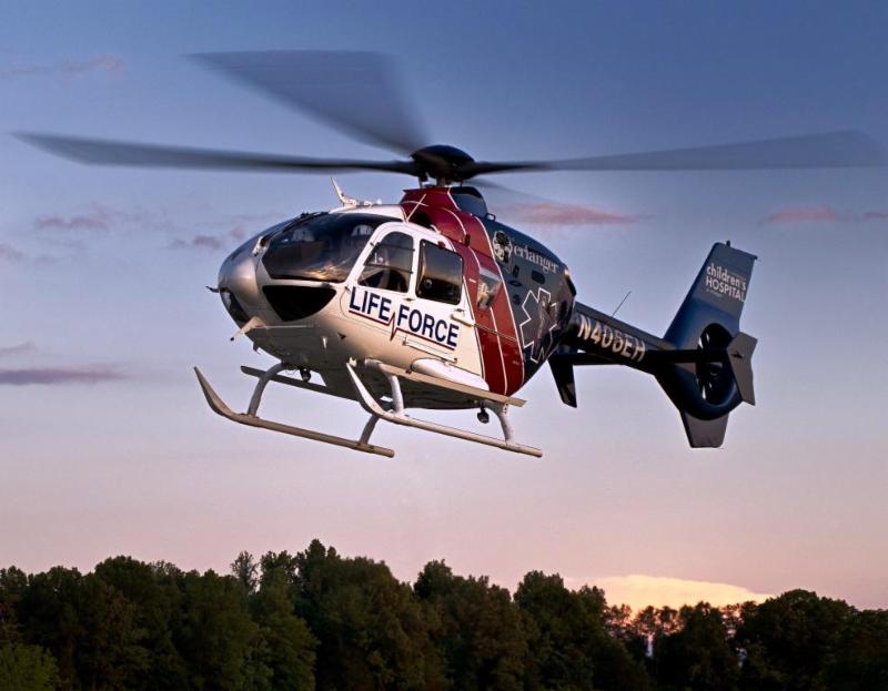
Baur provided an in-the-cockpit flight procedure validation to Avionics International demonstrating the use of RF approaches at one of the hospitals along the new route – Garrett County Memorial Hospital. His company is using a Garmin-equipped Robinson R66 featuring high resolution twin glass displays, and a digital autopilot with stability augmentation and ADB-B In and Out.
One of the central components enabling the new RF approaches is the 66’s Garmin GTN 650H flight management computer. The FMS featured a special navigation database reserved for flight inspection.
“This is historic,” Baur said, as he removed his hands from the controls and watched the GTN 650 autonomously control the R66 from waypoint to waypoint.
It’s the type of flying that Baur, a 40-year veteran helicopter pilot and airline captain, said is common in the commercial airline world but still limited to small pockets of the vertical flight community.
“We want to deliver these type of advanced helicopter Instrument navigation procedures, now common in the air carrier community, to our customers in the vertical flight community,” he said.
“The confluence of RF turns and LPV are used to mitigate heliport obstacles, terrain, noise and airspace issues, while providing safer, lower instrument approach minimums. It’s also wind independent, we noted the wind direction and velocity on each RF leg and recorded bank angles as well. The highest bank angle at any time within this approach was nine degrees. Typically in any helicopter PBN procedure design you want to use less than 20 degrees of bank angle,” he said.
The effectiveness of the RF leg was shown during the first flight demonstration Baur performed in December, which featured cross and tail winds ranging from 20-30 knots. Even in those conditions, the helicopter was able to perform with a cross track error of just 0.00-0.01, or remain within 60.7612 feet.
The procedure was created featuring helicopter RNP 0.3 and radius-to-fix segment coding as a demonstration procedure designed for use by the Maryland State Police.
Baur’s experience flying commercial airliners showed him that through experience the use of RF legs in en route airspace has little-to-no benefit for fixed wing operations. However, at lower altitudes, where helicopters need to fly within defined paths and avoid encroaching on nearby airspace when approaching heliports with terrain and environment obstacles, it can help the helicopter fly the approach more efficiently, especially in IFR conditions.
He sees the use of RF legs in PBN procedures holding massive benefits for reducing fuel and the number of track miles flown, as well as decreasing communication between pilots and controllers attempting to complete point in space helicopter landings.
As the PBN movement spreads into helicopters and the vertical flight community, the benefits in safety, accessibilities and efficiencies are clear, as operators leverage their investments in avionics, particularly in the United States and Europe. This is an example of industry and government collaboration, that has delivered success.
“In these cases, Hughes Aerospace develops a custom procedure, such as the one landing on the helipad at Garrett County Memorial Hospital, and provides this electronically to Garmin,” Bill Stone, senior manager of business development for Garmin’s aviation division said, describing the process of getting the new procedure into the Hughes R66 for flight testing and procedural validation with the FAA.
“Garmin then codes this procedure into a format which can be utilized by the FMS in the GTN 650/750. And finally we provide Hughes with an experimental custom database containing this procedure,” he said.
Garmin first added the use of radius to fix legs as one of the leg types used by the GTN through a 2016 software update. The approach procedures developed by Hughes are the first to take advantage of that update.
The GTN’s ability to autonomously control the collective is a standard capability on the GTN, according to Stone.
“This is a natural capability for our FMS’s such as the one in the GTN 650/750. The GTN has the ability to navigate complex flight plans and all ARINC 424 leg types for all phases of flight including departures, arrivals and approach procedures including the missed approach. Provided the aircraft is equipped with a compatible autopilot, the GTN can provide positive course guidance throughout the entire flight plan,” he said.


A depiction of the radius to fix waypoints on Garmin’s GTN 650.
Another company that was key to assisting Hughes in getting the new procedure developed and ready for flight testing verification is AeroNavData. The Illinois-based provider of navigation data coding is one of only four companies in the world with a type 1 letter of authorization to provide navigation data IFR procedures in fixed and rotary wing aircraft.
Their main role in the project was to take the raw aeronautical data provided by Baur and the Hughes design team – sourced from the actual flying and airspace waypoint creation of the new approaches – and provide verification and validation. They then sent a file to Garmin containing that source data for the new procedure, which was then converted into a binary machine readable format for the GTN flight management computer.
“ARINC has 23 different path terminators that we use to handle coding for RNAV, RNP or any type of PBN procedure,” Aeronavdata CEO Neal Covington said. “In this case, we were incorporating radius to fix legs into the coding of that raw data, which really just does not exist within helicopter operations today.”
Although the company’s navigation database contains more than 6,000 heliports in the western hemisphere, Covington said the majority of requests for design procedures related to RNP are for fixed wing cockpits.
“This opens up a whole new world for helicopter operators,” Covington said. “Almost all of the requests for coding we get related to the use of RNP has always been for fixed wing aircraft at high altitude, there is a whole world of low altitude operations and approaches that could benefit from this.”
Currently the Maryland State Police procedures are for FAA testing and data collection.


Here’s what the R44’s avionics displays look like depicting the radius to fix turn.
The better navigational and positional accuracy or containment through the use of RNP allows helicopters to operate in instrument meteorological conditions, requiring less airspace when supported by the space-based augmentation systems such as WAAS in the US or EGNOS in Europe. Other benefits include the use of vertical guidance which can have minimums of 250 feet height above surface landing and less than three fourths of a mile of visibility.
Helicopter pilots still continue to fly mostly visual flight rules approaches across emergency medical and law enforcement operations, which can be limited and exposed to icing conditions and reliant upon legacy ground-based navigation aids.
Previously, equipage requirements for the use of RNP routes, approaches and departures were resisted to the airlines or business jets equipped with dual flight management computers, dual inertial reference units and more. Today, helicopter operators can benefit from RNP as well with 0.3 COPTER RNP predicated on SBAS or WAAS.
The upgrades for PBN are also readily available today, as all current generation in-production twin engine helicopters feature navigation system packages that are compliant with international RNP helicopter airworthiness requirements.
There have been efforts to expand the use of PBN in commercial aviation operations through programs such as NextGen in the United States and the Single European Sky ATM Research project in Europe, but the focus in those programs has been fixed wing operations. As an example, the PBN information section of the FAA’s NextGen implementation overview features no mention of helicopters or heliports, with all of the focus centralized around Q and T routes and RNAV/RNP approaches in en route airspace for commercial airliners and business jets.
If an operator is RF equipped, they can operate an LPV approach as any other approach. It is simply required to be listed on the operator’s operation specification.
“The need certainly exists to implement modern navigation procedures for helicopter operators that have been enjoyed by the airline community as well. Now, we just have to keep proving it and show how it can change the way we view the heliport flight environment.”