Despite ongoing challenges in the avionics supply chain, the vertical lift community continues to work to advance many next-generation capabilities for commercial and military users.
Industry and military experts share excitement by the potential of open systems and other advances to enhance the vertical lift market, from empowering pilots with greater situational awareness, to enabling platforms to upgrade faster and more cost-effectively.
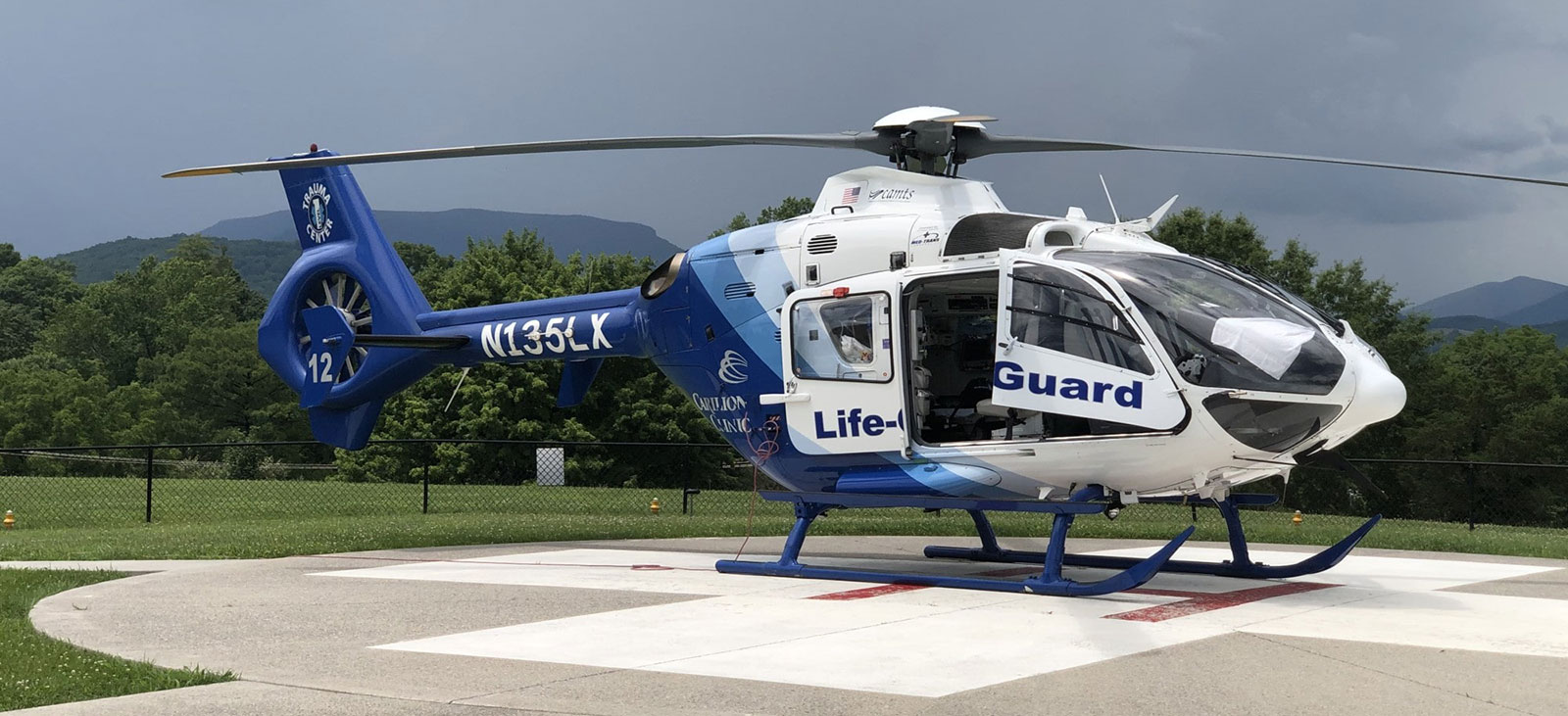
Helicopters have always posed unique challenges compared with their fixed-wing counterparts, including range and inability to operate in icing conditions along with a terrain- and obstacle-constrained environment that surrounds most heliports, explains Chris Baur, a helicopter pilot and president of Hughes Aerospace, the largest non-FAA Part 97 Service Provider who designs, implements, and maintains Instrument Flight Procedures in addition to surveying and certifying heliports for the FAA.
“Their maneuverability and ability to operate at reduced speeds can lure a pilot into a confrontation with Controlled Flight into Terrain, or CFIT, which can lead to an accident. The FAA doesn’t require commercial helicopter pilots to maintain instrument proficiencies, which also compounds the reluctance to operate Instrument Flight Rules (IFR),” he explains.
In fact, for every hour in the air, helicopters crash 35% more often than an average aircraft, according to an Aug. 2022 article in Executive Flyers.
Fortunately, the advent of GPS and new navigation technology advances are making helicopter operations safer, more efficient, and more accurate, with pilots benefiting from performance-based navigation (PBN).
PBN allows point-to-point trajectory-based flight operations without relying on legacy ground-based navigation. It also allows the helicopters to have all-weather access to low-altitude airspace, independent of fixed-wing traffic.
For vertical lift operators, Satellite-based Augmentation Systems (SBAS) take raw GPS and “brings the accuracy down from 10 meters to one to two meters,” Baur says. “Plus, you get a vertical profile, so now you can build the equivalent of a precision instrument landing system at a heliport.”
By developing better IFR infrastructure at lower altitudes, a major initiative by the U.S. Helicopter Safety Team (USHST), “we’ve increased the level of safety for helicopters in bad weather,” adds Rex Alexander, president of Five-Alpha LLC., who notes that one of the leading causes of helicopter accidents is Unintended Flight into Instrument Meteorological Conditions (UIMC).
U.S. accident statistics reveal that a helicopter pilot who unintentionally continues a Visual Flight Rules (VFR) flight into IMC, or weather conditions requiring pilots to fly under IFR, will very likely lose control of their aircraft and be dead within a median time of 56 seconds. Hughes worked with the FAA, Garmin, and other industry partners to develop, test, and publish the first Wide Area Augmentation System (WAAS)-enabled IFR Low Altitude Airways for Helicopters. WAAS is an air navigation aid developed by the Federal Aviation Administration to augment the Global Positioning System, with the goal of improving its accuracy, integrity, and availability.
Baur says these advances have enabled the industry to develop procedures that allow the helicopter to fly fewer track miles and be more environmentally friendly by avoiding noise-sensitive areas and using less fuel.
Glass Cockpits and Open Architecture
Cockpits also now include moving maps with multiple layers of data about routes, airspace, roads, and other navigation data. Pilots simply plug in their latitude and longitude to get to a specific point in space.
“A glass instrumentation panel with digital connectivity to an Electronic Flight Bag with navigation, Synthetic Vision Systems/Helicopter Terrain Awareness System, propagation of own ship display, traffic, airspace, weather, and many other tools is the modern architecture of a safer cockpit, particularly of single pilot operations, including IFR,” Baur says.
Armed with precise data of a glass cockpit, pilots can more quickly interpret speed, altitude, and position. But all this digitization comes at a cost since over-reliance on digital maps, for example, could result—over time—in pilots losing critical skills.
Garmin: More Scalable Digital Flight Displays
Some of the hottest advancements coming out of commercial industry include electronic flight instrumentation. Garmin recently received approval for its GI 275 electronic flight instrument for select Part 27 helicopters.
“The GI 275 can offer the many advantages of a digital flight display in a scalable solution that is a direct replacement for many older primary attitude indicators and horizontal situation indicators,” states Scott McCurley, manager, Aviation Marketing. “It also can serve as a multi-function display and provide navigation information via a built-in VFR GPS.”
Garmin currently offers a wide array of navigation solutions for helicopters, from forward-fit options such as its G1000H NXi flight deck to the G3000H and G5000H flight decks.
According to McCurley, these systems integrate navigation functions with other flight data and are IFR capable when properly equipped. Retrofit choices include Garmin’s GNC 255 navigation radio, as well as its GTN Xi GPS/Nav/Comm/MFD systems.
“Our GTN Xi navigators can provide advanced GPS navigation capabilities—such as search & rescue patterns—to many helicopters as a retrofit solution. The GTN Xi series also integrates with our G500H TXi flight displays and GFC 600H flight control system to fly the desired flight plan.”

MOSA as a Tool to Iterate Rapidly, Manage Obsolescence
One driver for innovation in the military vertical lift market is the DoD’s Modular Open Systems Approach (MOSA). Introduced in May 2021, this engineering design methodology “calls for common hardware across platforms and navigation networks,” explains Jim Sherman, Aviation Forum Executive, AIAA.
According to PEO Aviation, MOSA will lead to components that are more readily interchangeable, upgradable, and interoperable.
Traditionally, the services had to go back to the OEM every time they wanted to upgrade to a new capability because it required integration with flight safety on the front end of the helicopter.
“Instead of bringing in a box into the front end of the aircraft, we have a waveform and 3U Open VPX cards that will allow us to plug and play cards inside the aircraft based on mission requirements or different threats,” says Col. Burr H. Miller, PM of Aviation Mission Systems and Architecture for PEO Aviation. “This is much quicker than undergoing a whole cycle of installing and qualifying a brand new box inside the aircraft.”
PEO Aviation is collaborating with PEO Command, Control, Communications-Tactical (C3T) to develop a standardized MOSA-based chassis for mounted installations containing both communications and position, navigation, and timing (PNT) capabilities. The approach makes maintenance and upgrades more affordable by enabling component reuse and will lower the barrier of entry for technology insertions, while reducing schedule pressure and supply chain risk.
Col. Robert Freeland, U.S. Marine Corps Ret., government relations director for the Bell unit of Textron Inc., observes that military vertical lift programs are transitioning “from monolithic proprietary stovepipe solutions” to a new reality where the services “can integrate best-of-breed navigation systems faster to a much broader segment of the conventional force.”
“The beauty of future vertical lift is the open system approach and digital backbones on everything. We’re seeing a lot of software upgrades to improve the operator experience,” adds the former Marine pilot who spent 16 years flying the V-22 Osprey.
Bell provides the services with fly-by-wire aircraft and an open architecture digital backbone to rapidly test new capabilities. According to Freeland, the automation introduced to fly-by-wire systems “reduces the cognitive task load in the cockpit and allows you to do a lot more missions in the course of a seven- or eight-hour flight. You don’t get as mentally fatigued with the help of automation and you can adapt to changes and manage the mission on the fly because you have so much more information in the cockpit to tap into.”
Bell’s V-280 Valor tiltrotor aircraft, recently selected to replace the U.S. Army Black Hawk helicopter, is an example of the advanced features coming in future vertical lift aircraft.
Meeting the Army’s 2030 requirements for large-scale combat operations in multi-domains requires a strong focus on the future vertical lift fleet, but not at the expense of the enduring fleet, says Miller.
He explains that while commercial innovation can enable a move to new technology relatively rapidly, the Army’s enduring fleets often operate with older technology. “It’s staying ahead of the obsolescence curve—making sure that we can get the things that we need to manufacture the capability inside the aircraft at speed and at cost to our current budget,” says Miller, adding that he’s seeing a lot of industry engagements around MOSA to address this issue.
“For the military services, program managers can maintain an affordable system sustainable from an obsolescence management and upgrade perspective across the lifecycle. That has been out of reach in the past,” says Freeland, noting that advanced capabilities historically have been expensive to integrate into military platforms because of the way military systems were architected.
“You haven’t seen the iteration because the burden of incorporating them across broader conventional fleets has been too high,” Freeland says.
Accelerated Adoption of M-Code
Military vertical lift fleets are not only benefiting from MOSA; they also will be outfitted with the next generation of military GPS signal technology, M-Code, which offers enhanced jamming resistance, operating in the L1 and L2 GPS bands. M-Code will replace the military’s SAASM GPS technology on any DoD system that carries GPS signals, from handheld devices to fixed-wing and vertical lift aircraft.
“Many of the new features we are targeting for this market are aimed at adding robustness through GPS-degraded environments,” states Jared Louwagie, vice president of Navigation and Sensors for Honeywell Aerospace.
GPS’s prevalence across a wide variety of applications, from avionics to cell phones to ground vehicles, has created more GPS jamming and spoofing events, he notes.
“This is particularly true with helicopters operating closer to the ground and near densely populated environments where jammers can be present, as well as those flying in a military environment where the jamming and spoofing events are targeted by hostile forces,” he says.
The Army recently completed the first test flight of M-Code technology with industry partner Honeywell Aerospace.
“What’s really exciting for that platform is we coupled it with our new anti-jam technology—a nulling antenna that allows us to also null out some of those spurious systems to impact the signal that we’re receiving in the aircraft,” says Miller.

For the military market, Honeywell supplies the Embedded GPS/INS, commonly referred to as the EGI. The EGI contains the Selective Availability Anti-spoofing Module (SAASM) or PPS GPS receiver and delivers a tightly coupled GPS/Inertial Navigation System, Louwagie says.
The solution’s robust position source works even through temporary GPS outages, he adds.
According to Miller, the effort has been ongoing for five years. He expects box-level qualification of the EGI by the end of FY 2023, with the first installations on the Army’s vertical lift aircraft fleet set for FY 2024.