Hughes Aerospace and Honeywell Aerospace have announced a partnership with Myanmar’s Department of Civil Aviation to bring Performance Based Navigation (PBN) procedures to the nation’s busiest airports.
Hughes Aerospace President and CEO Chris Baur, an air transport, business jet, helicopter and General Aviation (GA) pilot with more than 35 years of commercial and military flying experience, will be traveling to Myanmar to perform a flight validation of the new takeoff and landing routes. Myanmar’s two main international airports, Yangon and Mandalay could use the new procedures to reduce overload in air traffic, as they currently handle a combined three million passengers annually. Hughes, in partnership with Honeywell, has helped to lead some of the biggest airspace redesign projects throughout the U.S., Europe and the Middle East, leading the transition into this new global era of taking advantage of onboard equipment to fly safer and more efficient landings and takeoffs.
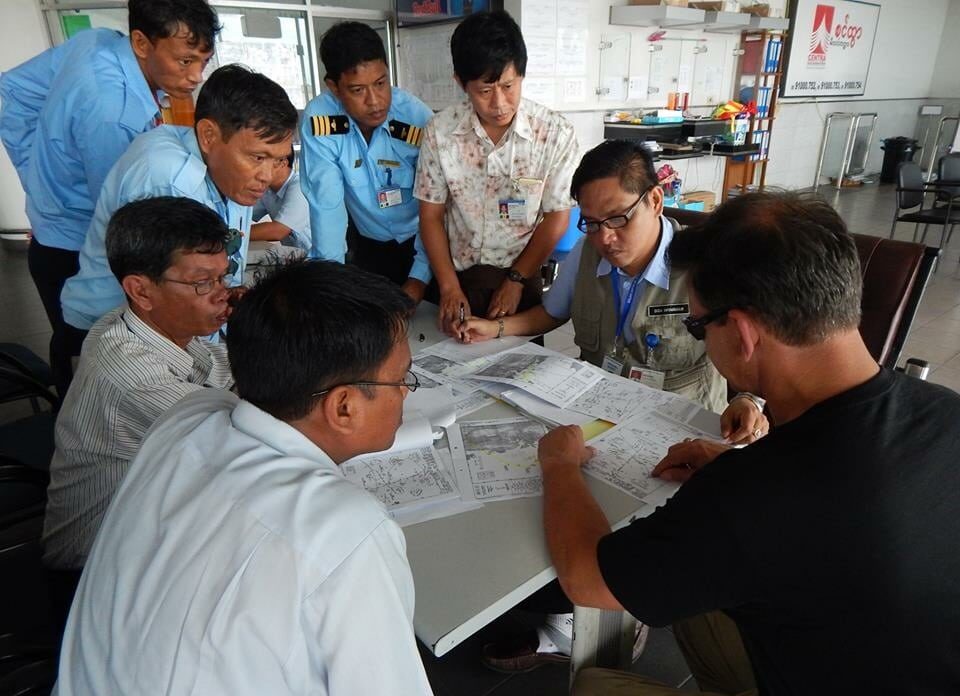
“In Myanmar, we were early to go into the country and show them what the benefits are, we’re working with them right now doing some validation of the procedure concepts that they came up with at Yangon and Mandalay,” Baur told Avionics Magazine. “Yangon is their capital and busiest airport. I’ll be going over myself in January to meet with the directorate general and his staff and fly the procedures.”
The Myanmar airports are part of the Asia-Pacific region, which is currently experiencing some of the fastest increases in demand for air transportation services. As that demand continues to rise, civil aviation authors face the challenge of safely increasing capacity, efficiency, and access, particularly in regards to some of the terrain-challenged airports in the region. Currently, Hughes and Honeywell are among third-party developers of PBN procedures that are certified by the International Civil Aviation Organization (ICAO) to help the international aviation community transition to a global performance-based airspace.
“Utilizing our combined expertise in PBN procedure design, process and quality control, navigation database creation, and Flight Management Systems, our team is reviewing and validating a number of new [Global Navigation Satellite System] GNSS-based departure and arrival procedures developed by the Myanmar Department of Civil Aviation,” Brian Davis, vice president of the Asia Pacific airlines division at Honeywell, told Avionics Magazine.
“Beyond Myanmar, we are active in numerous projects all around the world to promote, support and enable the global movement to adopt PBN for enhanced aviation safety and efficiency,” Davis added.
The main benefits of PBN procedures for airlines are their ability to address current limitations of air transportation capacity. Some of the specific advantages include, “better access to terrain/airspace-challenged airports; parallel runway, converging and adjacent airport operations; lower Minima resulting in fewer weather-related delays and diversions; reduced flight time due to optimized routing; and more reliable, repeatable flight paths,” said Davis.
Hughes and Honeywell also recently introduced PBN procedures in the Philippines. In 2013, Typhoon Haiyan hit the Philippines’ Daniel Z. Romualdez Airport in Tacloban as well as surrounding areas. The Typhoon knocked out the airport’s sole ground-based navigation aid, causing them to make a transition to PBN and switching to satellite-based technologies that use area navigation procedures in order to enable a lowering of the approach minimums that were in place using the legacy aids prior to the occurrence of the disaster.
“We made the offer of providing them with the flight procedures at no cost. We subsequently got a license to be a third-party public procedure design organization by the government of the Philippines and we presented our procedures to the director general of the Philippines,” said Baur, adding that the airport and airlines that fly there are now developing the new procedures.
“When you look at the [VHF Omnidirectional Range] VOR approach that was there before, the VOR was destroyed by the Typhoon. The GNSS procedure that we built that was GPS-based, provided them with lower minimums than the VOR and obviously its Typhoon-proof, there’s nothing on the ground for them to maintain and they’re going to get more benefit out of it — and in the process we made the approach and the transition much more efficient, which reduced the amount of track miles that the aircraft would fly so it reduced the environmental impact as well as the fuel used by the aircraft used to service Tacloban,” Baur said.
Now, Honeywell and Hughes are bringing their integrated CNS approach to deploy PBN with a focus on the inter-relationship between Air Traffic Control (ATC) engineering, Safety Management Systems (SMS) and flight operations to the two busiest airports in Myanmar. According to Baur, the majority of aircraft flying into both Yangon and Mandalay airports in Myanmar have the onboard FMS and GPS technology required to fly the new more efficient procedures.
“We work with differential GPS, which is really the future,” said Baur, adding that most GPS systems have about a 10 meter accuracy in measuring the position of the aircraft along its flight path during an approach to the airport. “If you can augment the GPS signal, you can bring the accuracy down consistently. One way that it’s done is through space-based augmentation, or SBAS, which in the U.S. they would call WAAS. That’ll bring the accuracy down to one to two meter accuracy as you know you can develop a three-dimension path in space, and [Localizer Performance with Vertical guidance] LPV approach and that LPV approach will give you essentially what a CAT I [Instrument Landing System] ILS would without the ground-based infrastructure,” said Baur. “The other part of differential GPS is GBAS, or Ground-Based Augmentation. GBAS takes the GPS constellation and brings it down to a 10 centimeter accuracy.”
Bauer said the Honeywell-Hughes partnership will have more announcements about new PBN projects throughout the Asia-Pacific region and other parts of the world in early 2015.
“Any time somebody publishes a procedure I celebrate it, it’s a victory, it’s what the aviation community is gradually moving toward,” said Baur. “Most of the world is evolving and the low-hanging fruit seems to be GNSS approaches, GPS-based [Standard Instrument Departures] SIDs and [Standard Terminal Automation Replacement Systems] STARs.”
See more at: http://www.aviationtoday.com/av/topstories/83657.html?hq_e=el&hq_m=2993025&hq_l=11&hq_v=0bcf5e07bd#.VIHOQDHF-Ag